Marine GPS Units & Chartplotters
Marine GPS units and chartplotters for navigation and fishfinding, including standalone display units, combo GPS/chartplotters, and mapping/chart cards. Average rating 4.39 across 11 indexed products, with price tiers from budget to premium (avg $549) and brands like Garmin featured
Top Products

Navionics Plus Regions South marine and lake charts on SD/MSD
Navionics
Mid-Range
Humminbird LakeMaster Midsouth States Plus V3 Map Card
Humminbird
Mid-Range
Navionics US & Coastal Canada chart card
Navionics
Mid-Range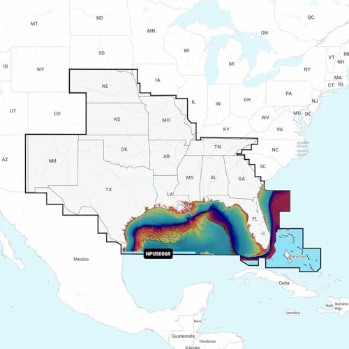
Navionics Platinum+ NPUS006R U.S. South marine GPS
Navionics
Premium
Simrad GO Chartplotter with Transducer, Radar Options
Simrad
Premium
Garmin ECHOMAP UHD2 53CV chartplotter with US Inland Maps
Garmin
Premium
Humminbird CoastMaster U.S. Coastal V1 Map SD Card
Humminbird
Mid-Range
Simrad GO chartplotter with transducer and radar options
Simrad
Premium
Simrad GO chartplotter with transducer and radar options
Simrad
Premium
Garmin ECHOMAP UHD2 73CV Chartplotter/Fishfinder
Garmin
Premium
Garmin GPSMAP 943xsv with SideVu/ClearVu sonar and Navionics mapping
Garmin
PremiumRoundups
Frequently Asked Questions
How do I choose the right screen size and resolution for a marine GPS/chartplotter?
Pick a screen size that matches your helm space and viewing distance—smaller boats often use 5–7 inch units while larger vessels benefit from 9–16+ inch displays; higher resolution improves map detail and readability in sunlight and at steep viewing angles
Which navigation features are essential versus optional?
Essential features include reliable GPS positioning, chartplotting with updatable marine charts, waypoint and route management, and a clear display; optional extras include built‑in sonar/fishfinder, radar integration, autopilot control, AIS target overlay, and networked sensors depending on fishing or offshore needs
Do I need a chartplotter that supports external sensors and networking?
If you plan to integrate radar, AIS, sonar, engine data, or multiple displays, choose a unit with NMEA 2000/NMEA 0183 or Ethernet networking to share sensor inputs and charts across devices; standalone units work for basic navigation on small boats
How much should I expect to pay for a marine GPS/chartplotter?
Entry-level units with basic chartplotting typically start in the low hundreds, mid-range systems with better displays and some sonar or networking cost several hundred to around a thousand, and high‑end integrated chartplotters with advanced sonar and networking can be well above that; the average across many listings is several hundred dollars
How do sonar and CHIRP fishfinder functionality differ between units?
Basic sonar shows depth and returns on a single frequency, while CHIRP transmits a range of frequencies to produce higher resolution, clearer target separation and bottom definition; compare available transducer types, power, and frequency ranges when shopping for fishing capability
What installation and maintenance should I expect?
Plan for a secure mount, proper power wiring with fuse or circuit protection, and safe routing for transducer and antenna cables; keep firmware and chart databases updated, protect the display from prolonged UV exposure, and inspect connectors and seals periodically to maintain water resistance