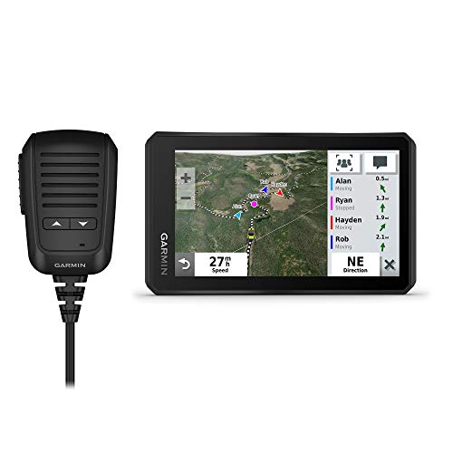
Garmin Tread Powersport Navigator, 5.5" display

Rugged powersports navigator with preloaded topo maps and US land boundaries. Robust screen for off-road use with mixed reviews on ease of use and map connectivity
Highlights
- preloaded topo maps
- large glove-friendly touchscreen
- land boundary data
Pros
- Rugged, weather-resistant design
- Large touchscreen display
- Preloaded topographic maps of North and Central America
- US public and private land boundaries
- Motor Vehicle Use Maps for FS roads and trails
Cons
- Mixed feedback on usability
- Mixed map accuracy and connectivity
- Some report issues with high-power cable
Best For
Features
- Rugged, weather-resistant IPX7 navigator with a 5.5-inch touchscreen
- Preloaded topographic maps of North and Central America and street maps
- U.S. public and private land boundaries with Forest Service roads and MVUMs
- Powered mount and wiring harness to secure the device on powersport vehicles
- Optional pairing with inReach satellite communicator (subscription required; sold separately)